

Vision on Technology for a Better World
At VITO, a Belgian research centre, we believe that together we can help the world thrive for at least 1,000 more years. We support companies, governments, and everyone involved in the quest for a new balance between people, nature, and the economy. As a science-to-technology partner, we are ready to support you with expert advice, practical technological innovations, or AI solutions for any sustainability challenge.
With our multidisciplinary expertise across more than 40 teams and unique lab, data, and testing infrastructure, we accelerate innovations towards a future where a circular economy, smart climate solutions, and a healthy living environment become a reality. Our mission is brought to life through the efforts of 1,300 inspired ‘visioneers’ and an extensive network of partners. Together, we translate science into innovative technologies and solutions that are effective, even in today’s complex reality. This is how we ensure that tomorrow’s world remains a great place for everyone.
VITO is proud to support this ‘Civil Security from Space’ project with more than 25 years of Remote Sensing expertise. VITO’s Remote Sensing team is at the forefront of remote sensing technology, specializing in research and development in Earth Observation (EO) automated data processing for satellite, airborne, and drone data.
Partnering with global entities, we drive advancements in agriculture, climate monitoring, ecosystem understanding, urban development, water quality management, infrastructure, and security through innovative geo-intelligence applications.
Remote Sensing Data for Civil Security
VITO’s Remote Sensing team contributes to the Smart-Connect roadmap through AI data compression of hyperspectral satellite imagery, drone analytics, and validation on wildfire and maritime security use cases. Below, we highlight some of our tasks.
Hyperspectral Satellite Imagery AI Data Compression for Efficient Information Management
During emergency situations, first responders need to be able to share and receive critical Earth observation (EO) data in real time. However, the data volume for granular hyperspectral satellite images quickly becomes a bottleneck.
Compressing these data with the help of our state-of-the-art AI-driven technology CORSA keeps the data manageable and reduces costs. Watch the video to see how the CORSA algorithm delivers near-lossless EO data compression
AI and Drone Detection for Wildfire Response
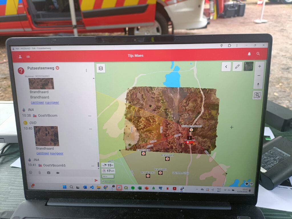
During wildfire field tests in Belgium and Portugal together with the national guard, fire brigades, civil protection, and the local commando posts, we demonstrated how drones coupled with AI can significantly enhance emergency response.
VITO’s Remote Sensing team developed a drone-based image mosaicking and automatic object detection technology. This solution enables firefighters to generate — in less than ten minutes — a geo-referenced aerial image with the automatic identification of people and vehicles, supporting faster decision-making in firefighting and rescue scenarios.

Vessel Detection for Maritime Security
In this field test, VITO will monitor suspicious and illegal ships in the North Sea with the help of high-resolution hyperspectral satellite data. Together with the Belgian Defence team and the Maritime information crossroad (MIK), we will demonstrate the use of AI-based detection on a strategic diversity of EO data.